Until recently, the deep-water areas along the Brazilian Equatorial Margin had been overlooked by the oil industry, but the recent giant discoveries made in the deep and ultra-deep waters of Guyana, Suriname and French Guyana have proven the existence of multiple active petroleum systems in the area. These discoveries, which have uncovered billions upon billions of barrels of oil, are in close vicinity to several exploration blocks that could be offered by the National Petroleum Agency (ANP) in upcoming bidding rounds for Brazil’s Equatorial Margin.
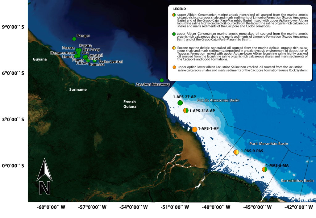
After completing our recent integrated petroleum system study of the Brazilian Equatorial Margin, it is clear that the plays and associated elements and processes of the petroleum systems identified in Guyana and Suriname are identical to those present in the Foz do Amazonas and Para-Maranhão basins (Fig. 1). These discoveries, including the supergiant giant deep-water Liza, Payara, Turbot, Ranger, Liza deep, Snoek, Pacora, Longtail, Hammerhead, Pluma, Tilapia and Haimara fields (ExxonMobil in Guyana), as well as the Maka and Sapakara fields (Apache in Suriname) and the Zaedyus field (Tullow in French Guyana), have generated massive proven recoverable reserves of light oil, with the already reaching up to 8 billion bbl to date.
Our study of the Equatorial Margin went far beyond conventional seismic and well-data mapping by applying state-of-the-art basin modeling and Advanced Geochemistry Technology (AGT) to oil samples recovered in the Foz do Amazonas and Para-Maranhão basins.
The AGT data indicates that the oils are mixtures of highly-cracked lacustrine and non-cracked marine oils sourced from at least three main source rocks and oil systems: the rift-upper Aptian–late Albian lacustrine Travosas/Codo formations, the drift-upper Albian–Cenomanian marine anoxic Limoeiro/Preguiças formations, and the drift-Eocene marine deltaic Travosas Formation.
In fact, these source rock systems overlap each other, which may enhance the efficiency of the hydrocarbon generation pods and migration charges. Furthermore, the fact that these distinct source rocks have different activation energies increases the chances of obtaining multiple charge pulses over a potentially wide time-window, drastically boosting the potential for successful entrapment in the reservoirs.
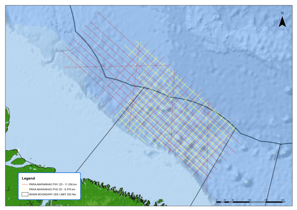
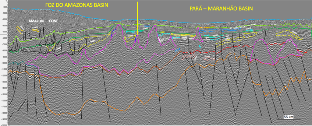
Finally, the new state-of-the-art 2D seismic data acquired by TGS in the Foz do Amazonas and Para-Maranhão basins (Figs. 2 and 3) supports this view that the region could be a sleeping supergiant deep-water hydrocarbon frontier.