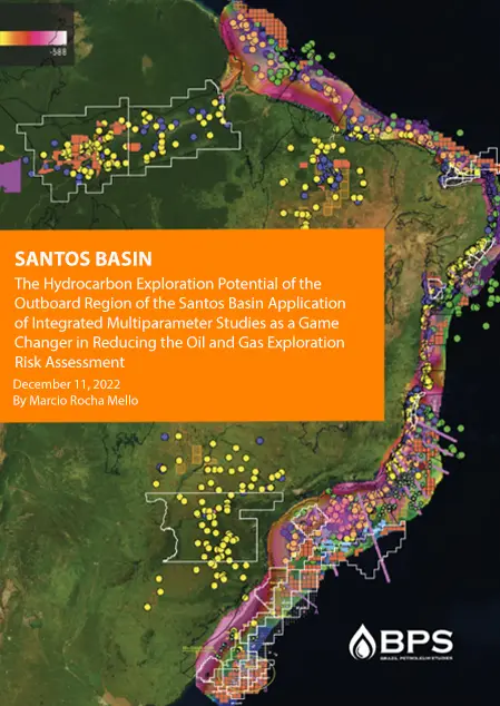
Multiclient

Santos

Located in south east region of Brazil between the Campos basin to the north, and the Pelotas basin to the south, Santos Basin covers an area of 352,000 km². Petrobras discovered more than 40 Bn boe, in Pre-Salt Play in the last decade. This geological play is the home of the supergiant and giant light oil fields such Lula, Sapinhoá, Búzios, Libra, franco, Guara, Iracema, Iara, Jupite, etc. In the last five years, the average annual daily production of the pre-salt wells grew from ~ 100 Kboe/day to over 1,000 Kboe/day at the end of 2016.

There are two main source rocks in the Santos Basin, the Hauterivian-Aptian pre-salt lacustrine shales of the Guaratiba Group, correlative to the Lagoa Feia Formation in adjacent Campos Basin, and the Turonian-Maastrichtian deep-water shales of Itajai-Açu Formation. Most of the giant oil fields in the Santos basin were charged from the Hauterivian-Aptian shales. Main reservoirs in the basin are the Hauterivian-Aptian carbonates (microbialites) of the Guaratiba Group, followed by Turonian-Maastrichtian turbidite sandstones of the Itajai-Açu Formation (Ilhabela Member) and shallow platform sandstones of the Campanian-Maastrichtian Juréia Formation.

The Santos Basin studies are a landmark on the understanding the hydrocarbon generation and migration process, oil and gas accumulation, and losses in the basin, throughout geological time.

3D Petroleum System Modeling and Exploration Risk Assessment of the Plays, Leads and Prospects of the Rift and Drift Sections of Southern Santos Basin

Santos Basin covers an area of 352,000 km². Petrobras discovered more than 40 Bn boe, in the Pre-Salt Play in the last decade. This geological play is the home of the supergiant and giant light oil fields such Lula, Sapinhoá, …

3D Petroleum System Modeling and Exploration Risk Assessment of the Plays, Leads and Prospects of the Rift and Drift Sections of Central and Northern Santos Basin

This study focuses on the Central Santos Basin portion. It is based on a 3D petroleum system analysis, risks assessment and petroleum leads mapping, based on the best geological, geophysical and geochemical information available. The tectonic framework of the Central …

3D Petroleum System Modeling and Exploration Risk Assessment of the Plays, Leads and Prospects of the Rift and Drift Sections of the Deep and Ultra Deep Areas encompassing the blocks of the Pre-salt Giant Oil Fields of the Southern Santos Basin

This project was developed in a large deep water area of Santos Basin, where important oil discoveries were made: Lula, Sul de Lula, Sapinhoá, Sul de Sapinhoá and Lapa. The basis of the project was a 3D seismic dataset that …

General Petroleum Geology and Geochemistry of the Santos Basin based on High Resolution Geochemistry and 2D Basin Modeling

This multiclient study is an example of good integration of high-resolution geochemistry approach with geological data that proved the existence of various petroleum systems, in shallow and deep offshore water areas of Santos Basin. This study was performed on a …

Hydrocarbon Potential Assessment of The Santos Cluster Area Based on Oil Slick, Piston Core and 2D Petroleum System Modeling Analysis

Satellite oil slick detection integrated with oil seep characterization using Piston Core Technology supported by high-resolution geochemistry is considered today a strategic technology for exploration in frontier basins were geophysical and geological data are scarce or non-existent for all major …

Temperature of Petroleum Formation from Kinetic Properties of Oils from Santos Basin

Kinetic parameters based on the asphaltene fractions in oils provide hydrocarbon generation potential of specific organic matter type. These are essential data that allow the calculation of cracking energies values to enhance basin model predictability. Representative oil samples were selected …

Select your currency

Leaving?

Sign up for our newsletter to receive the latest insights and exclusive studies from our experts