New tools to access Geochemical Logs and Natural Series integrated with Chrono, Litho and Tectonic phases vs. depth in the BPS Geodatabase
The assessment of source rock systems in a sedimentary basin is one of the most important tasks performed by petroleum geoscientists! With this in mind, the BPS Geodatabase has built a database with TOC and Rock-Eval pyrolysis data from more than 500 selected offshore wells, ranging from nearshore to ultra-deep waters. The data itself is a record of how prolific a basin is regarding oil and gas generation, migration, accumulation and preservation. However, to better understand the source rock system in a petroliferous basin, it is mandatory to integrate total organic carbon with Rock-Eval pyrolysis data. The petroleum system concept provides an effective means to identify, classify, characterize and predict the diversity of the source-rock systems, as well as a means to aid in the selection of the appropriate exploration analogs. The BPS Geochemical and Natural Series logs provide some of the best examples of how source rock data evolves over time, space and depth with respect to both level of certainty and areal and stratigraphic limits. The BPS interpretation tools allow easy and fast comparison of the source rock systems of areas, blocks, or basins in terms of source-rock organic-facies, depositional environment, maturity and potential yield. This data sets the limits for comparisons, similarities and differences that allow a direct approach to evaluate risk in petroleum exploration!
To access the Geochemical Logs, take the following quick steps. Once in the map view, users should make sure they have selected and activated Rock Geochemistry. Using either the area-wide or polygon selection tools, users can then select their wells of interest, which will appear along the right side of the screen. From there, users can select “View Geochemical Log” on the menu to the right of each well. The Geochemical Logs show users the Stratigraphy (Chrono or Litho), Organic Carbon, Hydrocarbon Generation Potential, Hydrogen Index, TMAX and Ro, and Free Hydrocarbons. Finally, there is also a zoom tool that allows users a better view of the top and base depth results. As with all our datasets, they can be easily printed or downloaded for use in external viewing tools.
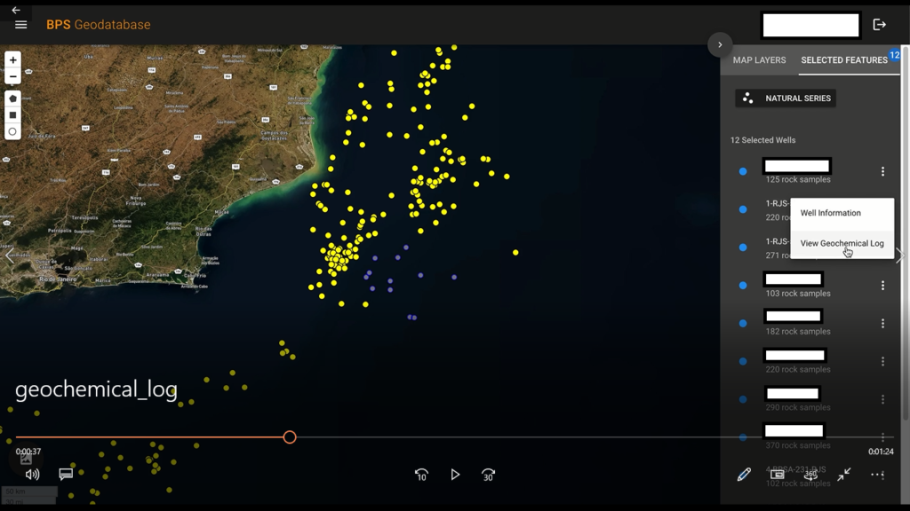
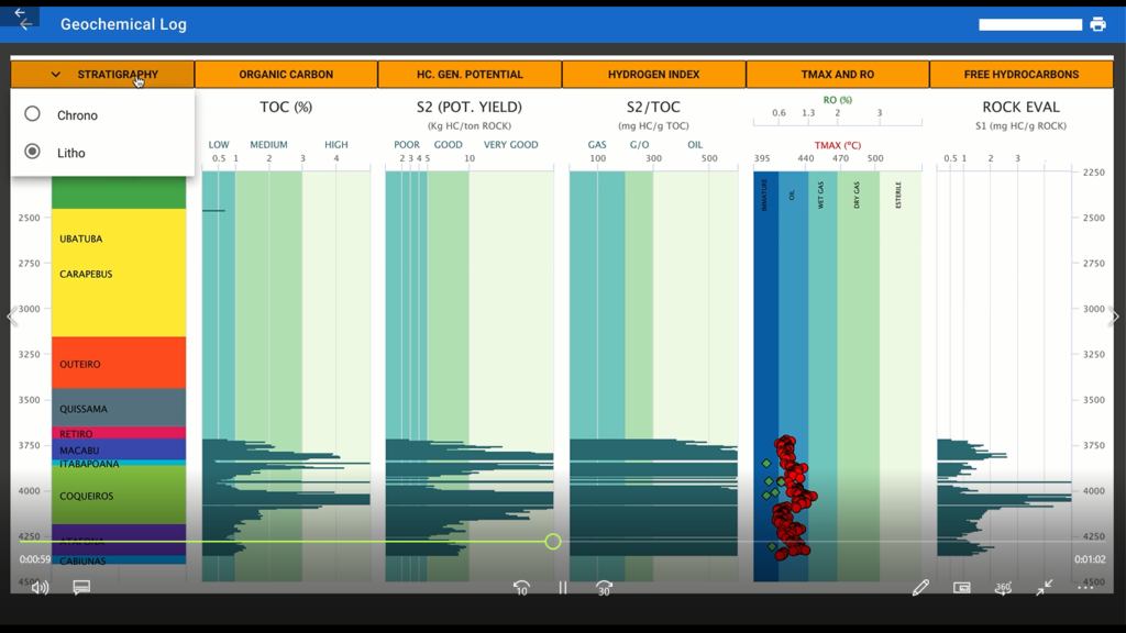
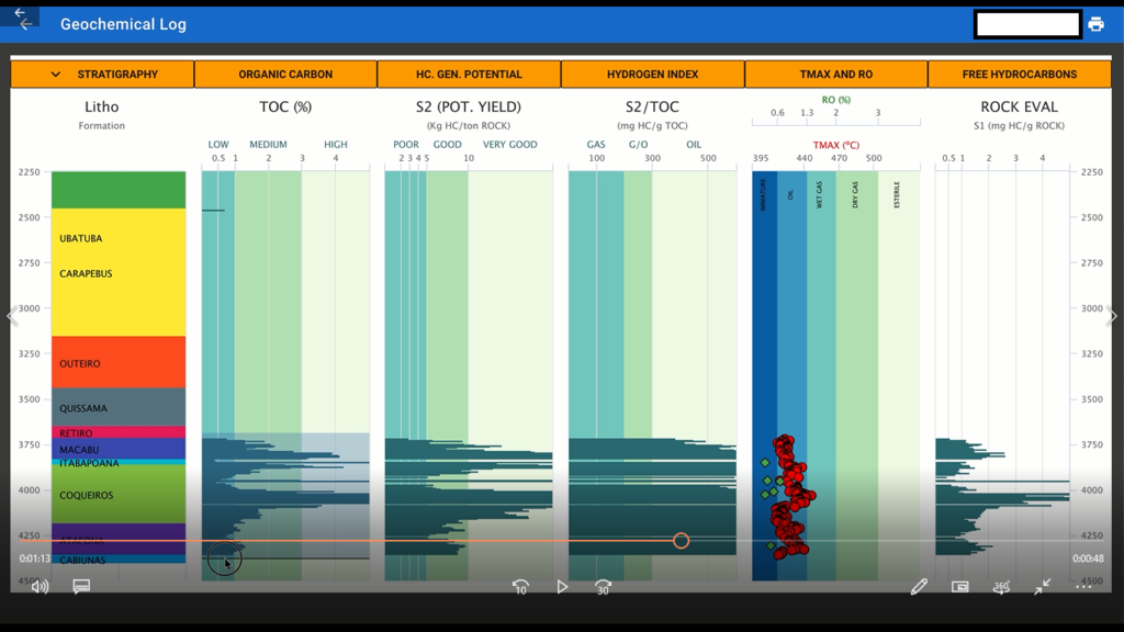
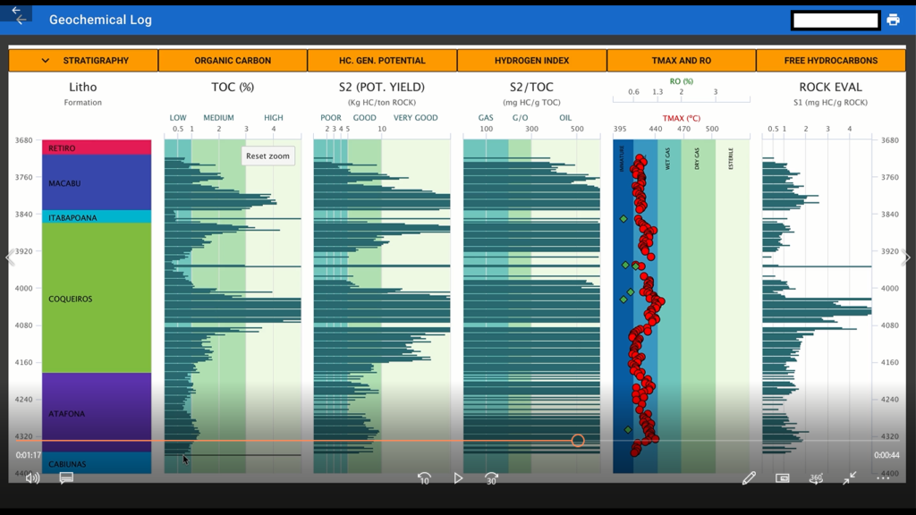
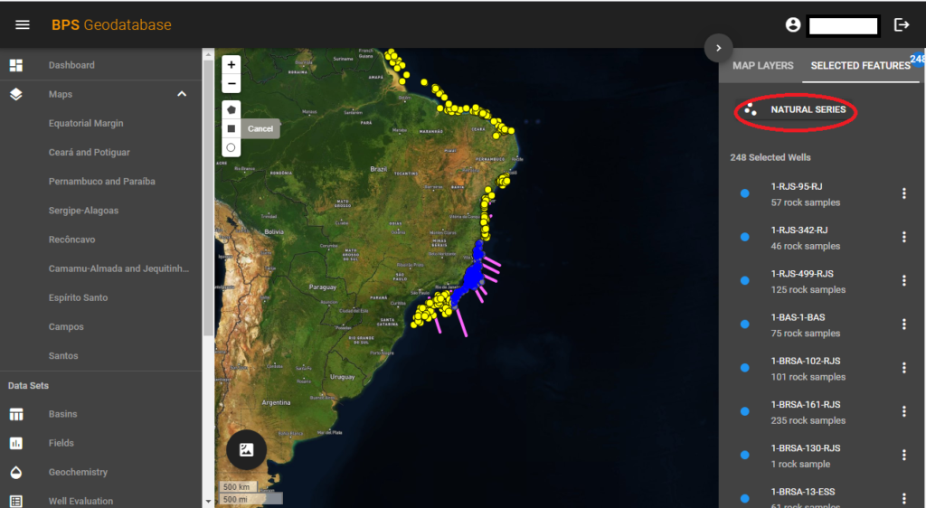
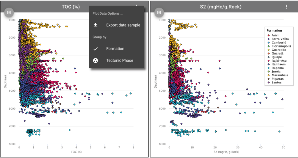
As for the Natural Series Logs, they can be accessed in a similar way. Once users have selected their wells of interest, they simply select “Natural Series” above the well list to get the plots of all selected rock samples. The plots include TOC (%), Hydrogen Index (HI-mg/HC/g. TOC), Potential Yield (S2-mg/HC/g.Rock), Free Hydrocarbon (S1-mg/HC/g.Rock), Oxygen Index (OI-mg/HC/g. CO2), TMAX (°C) and Vitrinite Reflectance (%Ro). Users also have the option to select Formation or Tectonic phases. Once again, check out the screenshots below!
Home / New tools to access Geochemical Logs and Natural Series integrated with Chrono, Litho and Tectonic phases vs. depth in the BPS Geodatabase

