Multiclient
Ceará and Potiguar
Home / Multi-client / Ceará and Potiguar
Bid Rounds
Multiclient studies available for the upcoming Bidding Rounds
Multi-client
Ongoing Multi-Client Studies
Studies for specific regions
Atlas
The Ceará Basin is located along the Equatorial margin of Brazil and it is subdivided into four sub-basins by structural grabens and internal highs (Mundaú, Icaraí, Acaraú and Piauí-Camocim). The petroleum systems are described as two main organic matter types: marine evaporitic oils and lacustrine oils which have been identified in different parts of the basin. The oils are present in reservoirs of various age: from Late Aptian (Paracuru Fm.) to Campanian and Santonian (Ubarana Fm). The reservoir rocks also vary from fluvial, deltaic and turbidite sandstones. Different types of organic matter have generated the oils and gases accumulated in the Ceará fields.
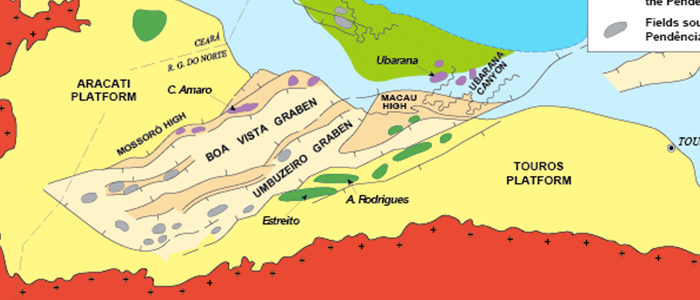
Potiguar Basin is one of the most prolific Brazilian sedimentary basins. Located in the equatorial margin of Brazil, it comprises almost 94,043 km² along the offshore and onshore areas. The exploratory history of the basin started in 70´s, and today the basin, in its onshore part, it is considered to be a mature basin. The basin currently produces ~49.6 Kbbl/day and a little over 1.2 Mm3/day of gas, from 85 fields.
Petroleum system of the basin comprises rift to post-rift, lacustrine to marine, prolific source rocks, spanning from Barremian (Alagamar – Pendencia Formations) through Cenomanian-Turonian age. Proven reservoir rocks range considerably in age, from Barremian to Eocene times. Seal rocks are observed throughout the entire stratigraphic column and are represented by intra-formational lacustrine shales of the Pendência Formation, shales of the Alagamar Formation (Aptian), fine-grained argillaceous sandstones and shales of the Açu Formation (Albian – Cenomanian), and thick deep marine pelitic rocks of the Ubarana Formation (Upper Cretaceous – Tertiary).
The multiclient studies offered in the Ceará basin are the most updated ever performed in Brazil. They show how the integration of tools ranging from satellite oil detection, piston core data, high resolution geochemistry, seismic interpretation and mapping could assist the 3D petroleum system modeling to classify the plays, leads and exploration targets in the deep and ultra-deep water areas.
- Ceará and Potiguar Products
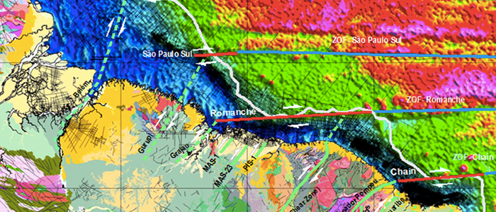
The tectonic stratigraphic record of offshore Ceará and Potiguar basins stacks the complete stages of a basin margin development (Rift, Transitional and Drift sequences). The evolution of these basins show significant horizontal tectonic movements during the rift phase associated with …
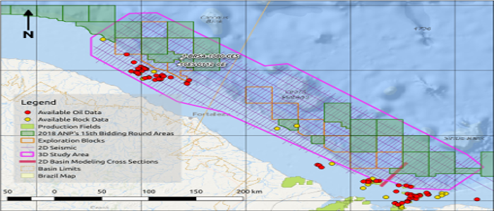
The area covered by this project involves 2D seismic interpretation of a dense grid located in the Piauí-Camocim and Acaraú sub-basins. Coverage of the Icaraí sub-basin involves regional 2D seismic lines. No seismic data from the Mundaú sub-basin was used …
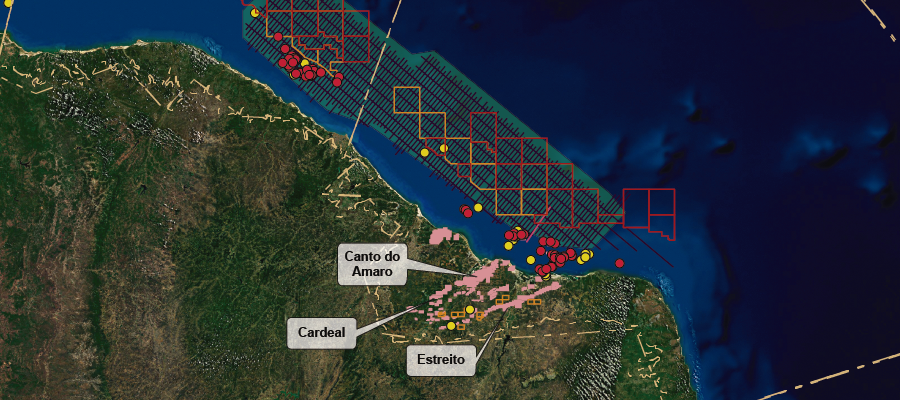
The use of Radarsat and Envisat Asar images processed together with meteorological and oceanographic data in the offshore of Rio Grande do Norte and Ceará states showed the presence of many oil slicks, widespread in water depth areas ranging from …
This multiclient study is an example of the integration of high-resolution geochemistry with geological data that outline the existence of an active overcharged rift and post-rift lacustrine and marine petroleum systems, not only onshore, but deep offshore in the Potiguar …